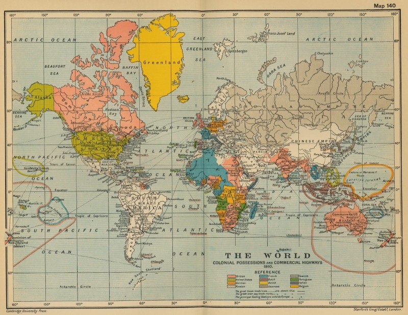
Vintage map of The World in the 1910s

1910 World Map — Colonial Possessions & Trade Routes | Vintage Historical Map Reprint
📜
Product Description:
Step back into the early 20th century with this beautifully detailed 1910 world map, originally published by Cambridge University Press and Stanford’s Geographical Establishment, London.
Titled “The World: Colonial Possessions and Commercial Highways”, this historic map captures the global empires, trade routes, and maritime networks that shaped the world before World War I.
This piece offers a fascinating snapshot of history — a time when the world’s oceans were lined with shipping routes and vast colonial territories stretched across continents. Perfect for history lovers, map enthusiasts, classrooms, or vintage décor.
🧭
Features:
- Original Publication Year: 1910
- Publisher: Cambridge University Press / Stanford’s Geographical Establishment, London
- Historical Focus: Colonial empires, maritime trade, and global communication routes
- Style: Restored vintage reproduction (public domain source)
- Finish: Available as high-quality print or digital download 1600x1239
- Ideal For: Office décor, study rooms, vintage galleries, or educational display
🖼️
Visual Details:
- Colored colonial territories
- Major sea cables and trade routes drawn in dotted lines
- Old-style typography and projection characteristic of Edwardian-era cartography
- Elegant cream-toned background for an authentic aged look
⚖️
Provenance & Rights:
This map is based on an original public domain work (1910). The design has been carefully restored for clarity and presentation while preserving its authentic vintage charm.